Earth Changes: Alaska Volcano Update: Bogoslof Eruption Shoots Ash Cloud Up 25,000 Feet

Residents in certain parts of Alaska found their cars and lawns covered in ash this week after the Bogoslof volcano erupted in the Aleutian Islands, sending a plume up 25,000 feet and spreading the smell of sulfur. And though the emissions had ended by Wednesday, the Alaska Volcano Observatory warned that the threat of "elevated unrest" continued.
"I don't see it slowing down any time soon," geophysicist Matthew Haney told KTVA. "I expect people will be talking about this eruption for many years and people will be coming back to the data streams, looking at it to learn more."
Bogoslof, which is located near Unalaska Island, is an uninhabited summit of a submarine volcano that extends nearly 5,000 feet above the sea floor, according to Volcano Discovery. It's been active since December, erupting more than two dozen times, but prior to that had been largely dormant for 25 years.
Monday's eruption — the latest — was "first detected by a series of discrete tremor bursts detected on nearby seismic stations" and followed by "an escalation of explosive activity" that included "numerous lightning strokes," according to the observatory. These conditions stretched into the night and Tuesday morning, causing the National Weather Service to issue high-level warnings to air traffic controllers, the Associated Press reported.
All the activity has caused the shape of Bogoslof Island to change. Previous eruptions came from a vent in shallow water, but more recently volcanic rock has created a barrier dividing the sea and the vent. That explained the ash that blanketed nearby towns this week.
"The last report of that amount of ash was in 1906," geologist Kristi Wallace told KTOO.
Authorities recommended people close their windows and doors, wear goggles while cleaning up the ash and keep their skin covered. Though ash did not pose a health risk, it did attract attention.
"We can look out across the bay a couple miles away and see that the formerly white snow is now a dusty pale gray," Jennifer Shockley, with the Unalaska Department of Public Safety, told the Alaska Dispatch News
For pics and video: http://www.ibtimes.com/alaska-volcano-update-bogoslof-eruption-shoots-ash-cloud-25000-feet-photos-2484556
First eruption of Piton de La Fournaise (Réunion island) in 2017 and unexpected discovery of an underwater volcanic eruption in Tonga
Everyday we find new signs of volcanic unrest across the world.
The Piton de La Fournaise (Réunion island) exploded for the first time in 2017 on January 31, 2017, while a volcanologist discovered unexpectedly a new underwater volcanic eruption in the Archipelago of Tonga studying satellite images.
Piton de la Fournaise: First eruption in 2017
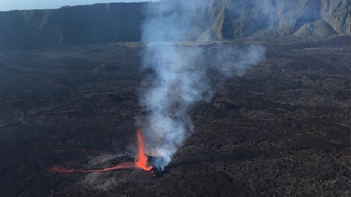
After signs of agitation at the end of January, a seismic crisis was triggered on the January 31, 2017 at 3:22pm, justifying the passage on alert 1 / probable or imminent eruption.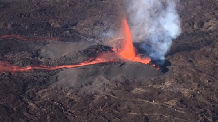
First images of the webcam of Piton de Bert suggest two active vents and the glow of a lava flow.
New morning images show an active zone downstream of the crack characterized by several 20-30 meter lava fountains, located at 1,100 meters at the SSE of Château-Fort.
Cracks that opened up at the beginning of the eruption are no longer active, but remain marked by fumaroles.
Underwater volcanic eruption Tonga Archipelago
An underwater volcanic eruption in the Tonga archipelago has just been discovered by geomorphologist Dr. Murray Ford of the University of Auckland while scanning satellite images.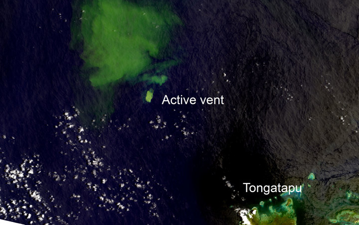
During an image digitization on January 31, 2017, he observed a large plume of 30 km by 20, not far from the formed island and only 33 km from Tongatapu, the main island of Tonga.
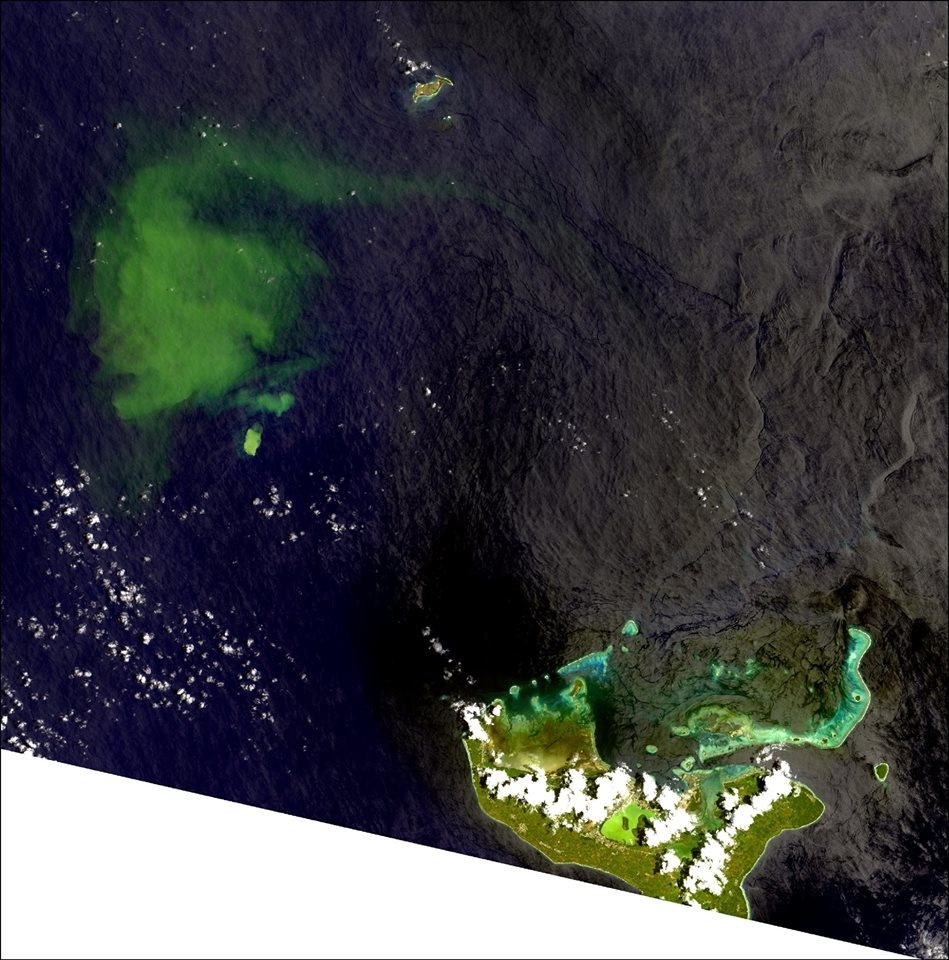
According to the scientist, the NASA EOS-Aura satellite did not detect any volcanic gas signature in the atmosphere … but underwater volcanic eruptions are often detected a moment after the event.
Planet X system is getting closer...