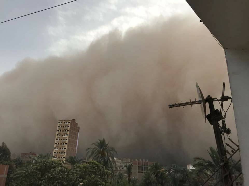
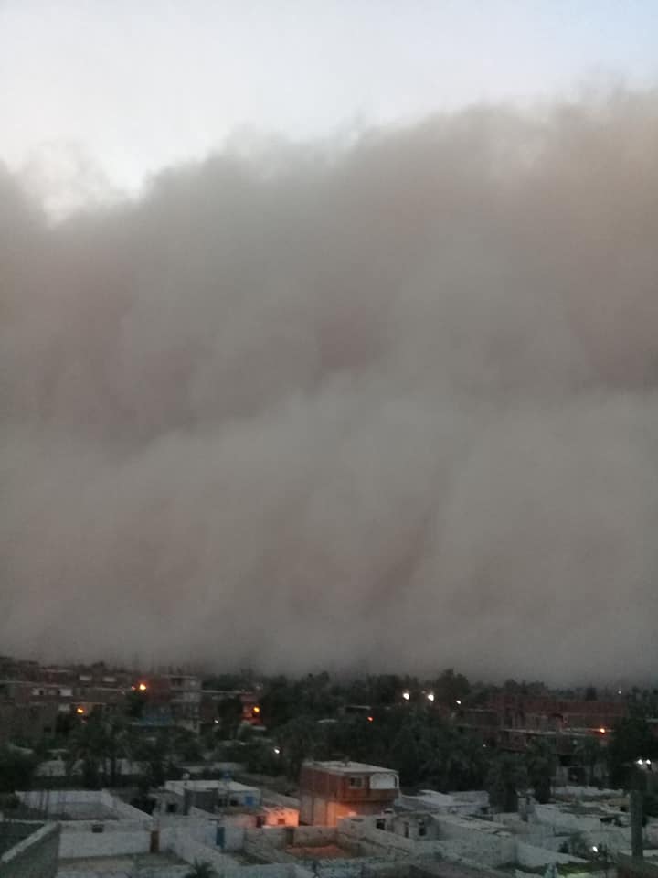
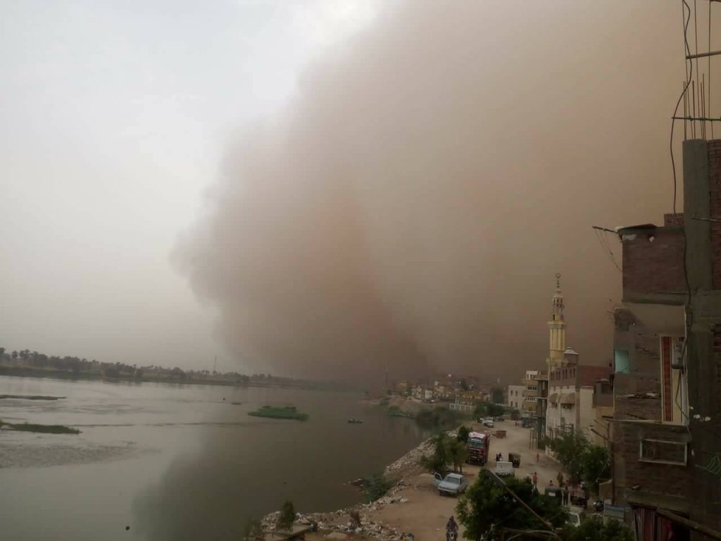
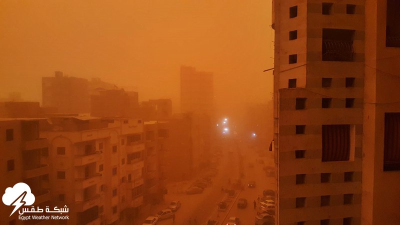
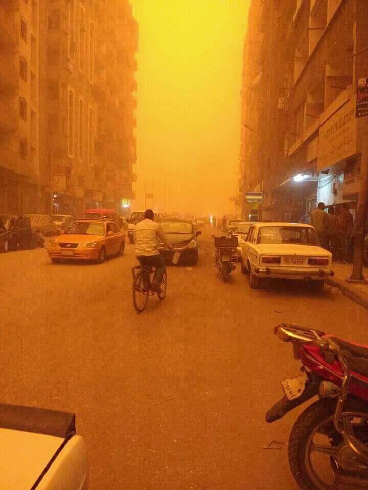
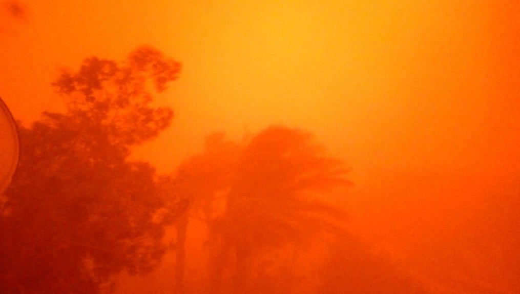
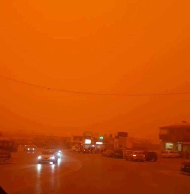
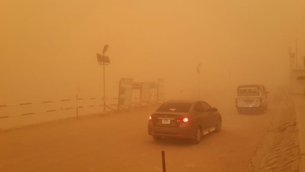
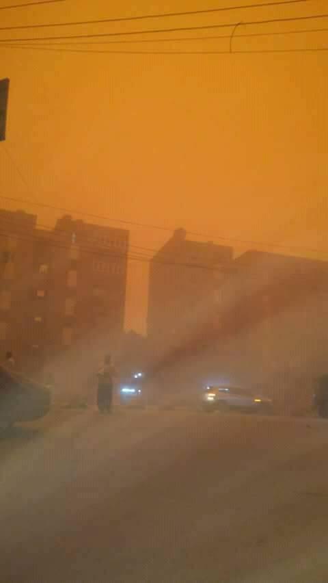
Sky turns APOCALYPTIC orange after biblical sandstorm engulfs Southern Egypt (VIDEO)
And here some very impressive images of the giant storm that engulfed southern Egypt on March 28, 2018:
MASSIVE QUAKE YESTERDAY 7.2!
The Weekly Volcanic Activity Report: March 21 - 27, 2018

New activity/unrest: Ambae, Vanuatu | Copahue, Central Chile-Argentina border | Ijen, Eastern Java (Indonesia) | Kick 'em Jenny, North of Grenada | Kirishimayama, Kyushu (Japan) | Myojinsho, Japan.
Ongoing activity: Agung, Bali (Indonesia) | Aira, Kyushu (Japan) | Dukono, Halmahera (Indonesia) | Ebeko, Paramushir Island (Russia) | Kilauea, Hawaiian Islands (USA) | Mayon, Luzon (Philippines) | Popocatepetl, Mexico | Sabancaya, Peru | Sheveluch, Central Kamchatka (Russia) | Suwanosejima, Ryukyu Islands (Japan) | Turrialba, Costa Rica | Villarrica, Chile.
The Weekly Volcanic Activity Report is a cooperative project between the Smithsonian's Global Volcanism Program and the US Geological Survey's Volcano Hazards Program. Updated by 23:00 UTC every Wednesday, notices of volcanic activity posted are preliminary and subject to change as events are studied in more detail. This is not a comprehensive list of all of Earth's volcanoes erupting during the week. Carefully reviewed, detailed reports on various volcanoes are published monthly in the Bulletin of the Global Volcanism Network.
New activity/unrest
Ambae, Vanuatu
15.4°S, 167.83°E, Summit elev. 1496 mBased on satellite data, webcam observations, and wind model data, the Wellington VAAC reported that during 21-27 March ash plumes from the vent at Ambae’s Lake Voui rose to altitudes of 3-4.6 km (10,000-15,000 ft) a.s.l. and drifted mainly S and SW, but towards the end of the week to the N and W. News articles noted that ashfall had significantly impacted the S and W parts of the island, damaging crops, contaminating water, and collapsing homes, leading to the evacuation of three villages. On 25 March a flight was cancelled. Residents of Santo reportedly witnessed incandescent material being ejected as high as 1 km around 1800 and 2200; residents also noted four more events during the next morning that were also heard in Pentecost and Maewo.
Geological summary: Ambae, also known as Aoba, is a massive 2500 km3 basaltic shield that is the most voluminous volcano of the New Hebrides archipelago. A pronounced NE-SW-trending rift zone dotted with scoria cones gives the 16 x 38 km island an elongated form. A broad pyroclastic cone containing three crater lakes is located at the summit within the youngest of at least two nested calderas, the largest of which is 6 km in diameter. Post-caldera explosive eruptions formed the summit craters of Lake Voui (also spelled Vui) and Lake Manaro Ngoru about 360 years ago. A tuff cone was constructed within Lake Voui about 60 years later. The latest known flank eruption, about 300 years ago, destroyed the population of the Nduindui area near the western coast.
Copahue, Central Chile-Argentina border
37.856°S, 71.183°W, Summit elev. 2953 mAccording to ONEMI, OVDAS-SERNAGEOMIN reported that a hydrothermal explosion at Copahue was recorded on 24 March, along with increased tremor. The Alert Level was raised to Yellow (second highest level on a four-color scale); SERNAGEOMIN recommended no entry into a restricted area within 1 km of the crater. ONEMI maintained an Alert Level Yellow (the middle level on a three-color scale) for the municipality of Alto Biobío.
Geological summary: Volcán Copahue is an elongated composite cone constructed along the Chile-Argentina border within the 6.5 x 8.5 km wide Trapa-Trapa caldera that formed between 0.6 and 0.4 million years ago near the NW margin of the 20 x 15 km Pliocene Caviahue (Del Agrio) caldera. The eastern summit crater, part of a 2-km-long, ENE-WSW line of nine craters, contains a briny, acidic 300-m-wide crater lake (also referred to as El Agrio or Del Agrio) and displays intense fumarolic activity. Acidic hot springs occur below the eastern outlet of the crater lake, contributing to the acidity of the Río Agrio, and another geothermal zone is located within Caviahue caldera about 7 km NE of the summit. Infrequent mild-to-moderate explosive eruptions have been recorded at Copahue since the 18th century. Twentieth-century eruptions from the crater lake have ejected pyroclastic rocks and chilled liquid sulfur fragments.
Ijen, Eastern Java (Indonesia)
8.058°S, 114.242°E, Summit elev. 2769 mBased on information from residents of Sempol (8 km W), PVMBG reported that 27 people in Watu Capil village (7 km NW) required medical treatment after exposure to sulfur dioxide gas from Ijen at 2100 on 21 March. The path from Paltuding (SW base) to the top of the crater was closed as a result. During 21-22 March white plumes rose 100-200 m above the summit area; there were no visible changes in the emissions after the incident. PVMBG noted that there had been three occurrences of anomalous gas concentrations during January-March. The Alert Level remained at 1 (on a scale of 1-4), and residents and visitors were advised to not approach the crater rim or crater floor.
Geological summary: The Ijen volcano complex at the eastern end of Java consists of a group of small stratovolcanoes constructed within the large 20-km-wide Ijen (Kendeng) caldera. The north caldera wall forms a prominent arcuate ridge, but elsewhere the caldera rim is buried by post-caldera volcanoes, including Gunung Merapi, which forms the high point of the complex. Immediately west of the Gunung Merapi stratovolcano is the historically active Kawah Ijen crater, which contains a nearly 1-km-wide, turquoise-colored, acid lake. Picturesque Kawah Ijen is the world's largest highly acidic lake and is the site of a labor-intensive sulfur mining operation in which sulfur-laden baskets are hand-carried from the crater floor. Many other post-caldera cones and craters are located within the caldera or along its rim. The largest concentration of cones forms an E-W zone across the southern side of the caldera. Coffee plantations cover much of the caldera floor, and tourists are drawn to its waterfalls, hot springs, and volcanic scenery.
Kick 'em Jenny, North of Grenada
12.3°N, 61.64°W, Summit elev. -185 mOn 22 March the University of the West Indies (UWI) Seismic Research Centre (SRC) and the National Disaster Management Agency (NaDMA) reported that seismicity at Kick 'em Jenny continued to decline. The Alert Level was lowered to Yellow (the second lowest level on a four-color scale) and the maritime exclusion zone was adjusted to a radius of 1.5 km.
Geological summary: Kick 'em Jenny, a historically active submarine volcano 8 km off the N shore of Grenada, rises 1300 m from the sea floor. Recent bathymetric surveys have shown evidence for a major arcuate collapse structure, which was the source of a submarine debris avalanche that traveled more than 15 km W. Bathymetry also revealed another submarine cone to the SE, Kick 'em Jack, and submarine lava domes to its S. These and subaerial tuff rings and lava flows at Ile de Caille and other nearby islands may represent a single large volcanic complex. Numerous historical eruptions, mostly documented by acoustic signals, have occurred since 1939, when an eruption cloud rose 275 m above the sea. Prior to the 1939 eruption, which was witnessed by a large number of people in northern Grenada, there had been no written mention of the volcano. Eruptions have involved both explosive activity and the quiet extrusion of lava flows and lava domes in the summit crater; deep rumbling noises have sometimes been heard onshore. Historical eruptions have modified the morphology of the summit crater.
Kirishimayama, Kyushu (Japan)
31.934°N, 130.862°E, Summit elev. 1700 mJMA reported that the eruption at Shinmoedake (Shinmoe peak), a stratovolcano of the Kirishimayama volcano group, continued during 19-27 March. Lava effusion possibly stopped on 9 March, though the lava flow on the NW flank continued to advance. A high number of volcanic earthquakes continued to be recorded, in addition to many low-frequency earthquakes with shallow hypocenters. Short-duration volcanic tremor was occasionally recorded. During a field survey on 22 March scientists measured 600 tons/day of sulfur dioxide gas, and noted that the crack on the W flank had grown slightly larger. On 25 March an explosion at 0735 was followed by an ash plume that rose 3.2 km above the crater rim and ejected material as far as 800 m. An event at 0845 generated an ash plume that rose 2.1 km above the crater rim, and a very small pyroclastic flow that traveled 800 m W. Sulfur dioxide emissions were 300 tons/day on 24 March. The Alert Level remained at 3 (on a scale of 1-5).
Geological summary: Kirishimayama is a large group of more than 20 Quaternary volcanoes located north of Kagoshima Bay. The late-Pleistocene to Holocene dominantly andesitic group consists of stratovolcanoes, pyroclastic cones, maars, and underlying shield volcanoes located over an area of 20 x 30 km. The larger stratovolcanoes are scattered throughout the field, with the centrally located, 1700-m-high Karakunidake being the highest. Onamiike and Miike, the two largest maars, are located SW of Karakunidake and at its far eastern end, respectively. Holocene eruptions have been concentrated along an E-W line of vents from Miike to Ohachi, and at Shinmoedake to the NE. Frequent small-to-moderate explosive eruptions have been recorded since the 8th century.
Myojinsho, Japan
31.888°N, 139.918°E, Summit elev. 11 mJMA issued a warning on 24 March for the waters surrounding Myojinsho after reports from the Japan Coast Guard indicated discolored water from a possible eruptive event.
Geological summary: Beyonesu Rocks represent part of the barely exposed rim of the largely submarine Myojinsho caldera. Formation of the 8-9 km wide caldera was followed by construction of a large (2.6 km3) lava dome and/or lava flow complex on the caldera floor, originally located at a depth of 1000-1100 m. Most historical eruptions, recorded since the late-19th century, have occurred from the large post-caldera Myojinsho lava dome on the NE rim of the caldera. Deposits from submarine pyroclastic flows associated with growth of the dacitic lava dome mantle the conical dome and extend into the NE part of the caldera and down its outer slopes. An explosive submarine eruption from Myojinsho in 1952 destroyed a Japanese research vessel, killing all 31 on board. Submarine eruptions have also been observed from other points on the caldera rim and outside of the caldera. The Beyonesu Rocks were named after the French warship the Bayonnaise, which was surveying volcanic islands south of Tokyo Bay in 1850.
Ongoing activity
Agung, Bali (Indonesia)
8.343°S, 115.508°E, Summit elev. 2997 mIn a VONA, PVMBG reported that at 1009 on 26 March an event at Agung generated an ash plume that rose at least to an altitude of 3.6 km (11,650 ft) a.s.l. and drifted NW. The Alert Level remained at 3 (on a scale of 1-4) and the exclusion zone continued at a 4-km radius.
Geological summary: Symmetrical Agung stratovolcano, Bali's highest and most sacred mountain, towers over the eastern end of the island. The volcano, whose name means "Paramount," rises above the SE caldera rim of neighboring Batur volcano, and the northern and southern flanks extend to the coast. The summit area extends 1.5 km E-W, with the high point on the W and a steep-walled 800-m-wide crater on the E. The Pawon cone is located low on the SE flank. Only a few eruptions dating back to the early 19th century have been recorded in historical time. The 1963-64 eruption, one of the largest in the 20th century, produced voluminous ashfall along with devastating pyroclastic flows and lahars that caused extensive damage and many fatalities.
Aira, Kyushu (Japan)
31.593°N, 130.657°E, Summit elev. 1117 mJMA reported that there were 20 events at Minamidake crater (at Aira Caldera’s Sakurajima volcano) during 19-26 March, two of which were explosive. The first explosive event, at 0138 on 21 March, generated a plume that rose 1 km above the crater rim and into weather clouds. At 0228 on 26 March the second explosive event ejected tephra as far as 900 m from the crater and produced a plume that rose 2.8 km. The Alert Level remained at 3 (on a 5-level scale).
Geological summary: The Aira caldera in the northern half of Kagoshima Bay contains the post-caldera Sakurajima volcano, one of Japan's most active. Eruption of the voluminous Ito pyroclastic flow accompanied formation of the 17 x 23 km caldera about 22,000 years ago. The smaller Wakamiko caldera was formed during the early Holocene in the NE corner of the Aira caldera, along with several post-caldera cones. The construction of Sakurajima began about 13,000 years ago on the southern rim of Aira caldera and built an island that was finally joined to the Osumi Peninsula during the major explosive and effusive eruption of 1914. Activity at the Kitadake summit cone ended about 4850 years ago, after which eruptions took place at Minamidake. Frequent historical eruptions, recorded since the 8th century, have deposited ash on Kagoshima, one of Kyushu's largest cities, located across Kagoshima Bay only 8 km from the summit. The largest historical eruption took place during 1471-76.
Dukono, Halmahera (Indonesia)
1.693°N, 127.894°E, Summit elev. 1229 mBased on analyses of satellite imagery, wind model data, and notices from PVMBG, the Darwin VAAC reported that during 21-25 March ash plumes from Dukono rose to an altitude of 1.8 km (6,000 ft) a.s.l. and drifted S, SE, and E.
Geological summary: Reports from this remote volcano in northernmost Halmahera are rare, but Dukono has been one of Indonesia's most active volcanoes. More-or-less continuous explosive eruptions, sometimes accompanied by lava flows, occurred from 1933 until at least the mid-1990s, when routine observations were curtailed. During a major eruption in 1550, a lava flow filled in the strait between Halmahera and the north-flank cone of Gunung Mamuya. This complex volcano presents a broad, low profile with multiple summit peaks and overlapping craters. Malupang Wariang, 1 km SW of the summit crater complex, contains a 700 x 570 m crater that has also been active during historical time.
Ebeko, Paramushir Island (Russia)
50.686°N, 156.014°E, Summit elev. 1103 mBased on observations by volcanologists in Severo-Kurilsk (Paramushir Island), about 7 km E of Ebeko, explosions during 18 and 21-22 March generated ash plumes that rose as high as 1.8 km (5,900 ft) a.s.l. Ashfall was reported in Severo-Kurilsk on 17 and 21 March. The Aviation Color Code remained at Orange (the second highest level on a four-color scale).
Geological summary: The flat-topped summit of the central cone of Ebeko volcano, one of the most active in the Kuril Islands, occupies the northern end of Paramushir Island. Three summit craters located along a SSW-NNE line form Ebeko volcano proper, at the northern end of a complex of five volcanic cones. Blocky lava flows extend west from Ebeko and SE from the neighboring Nezametnyi cone. The eastern part of the southern crater contains strong solfataras and a large boiling spring. The central crater is filled by a lake about 20 m deep whose shores are lined with steaming solfataras; the northern crater lies across a narrow, low barrier from the central crater and contains a small, cold crescentic lake. Historical activity, recorded since the late-18th century, has been restricted to small-to-moderate explosive eruptions from the summit craters. Intense fumarolic activity occurs in the summit craters, on the outer flanks of the cone, and in lateral explosion craters.
Kilauea, Hawaiian Islands (USA)
19.421°N, 155.287°W, Summit elev. 1222 mDuring 21-27 March HVO reported that the lava lake continued to rise, fall, and spatter in Kilauea’s Overlook crater. Surface lava flows were active above and on Pulama pali. Webcams recorded incandescence from a small lava pond in a pit on the W side of Pu'u 'O'o Crater, and increased spattering which began on 22 March. Lava flowed out of a vent on the SE part of the crater onto the crater floor on 25 March, and expanded over the next few days.
Geological summary: Kilauea, which overlaps the E flank of the massive Mauna Loa shield volcano, has been Hawaii's most active volcano during historical time. Eruptions are prominent in Polynesian legends; written documentation extending back to only 1820 records frequent summit and flank lava flow eruptions that were interspersed with periods of long-term lava lake activity that lasted until 1924 at Halemaumau crater, within the summit caldera. The 3 x 5 km caldera was formed in several stages about 1500 years ago and during the 18th century; eruptions have also originated from the lengthy East and SW rift zones, which extend to the sea on both sides of the volcano. About 90% of the surface of the basaltic shield volcano is formed of lava flows less than about 1100 years old; 70% of the volcano's surface is younger than 600 years. A long-term eruption from the East rift zone that began in 1983 has produced lava flows covering more than 100 km2, destroying nearly 200 houses and adding new coastline to the island.
Mayon, Luzon (Philippines)
13.257°N, 123.685°E, Summit elev. 2462 mPHIVOLCS reported that during 21-27 March activity at Mayon included periods of gravity-driven lava advancement, gas-and-steam emissions, rockfalls, and quiescence. Lava flows were about 3.3 km, 4.5 km, and 1.9 km long in the Mi-isi (S), Bonga (SE), and Basud (E) drainages, respectively. Steam-and-gas emissions drifted mainly SW. At 1039 and 2133 on 23 March pyroclastic flows traveled 4-5 km down the Mi-isi drainage, producing light brown ash clouds that drifted SW. The Alert Level remained at 3 (on a 0-5 scale) and PHIVOLCS reminded residents to stay away from the 6-km-radius Permanent Danger Zone and the 7-km Extended Danger Zone on the SSW and ENE flanks.
Geological summary: Beautifully symmetrical Mayon, which rises above the Albay Gulf NW of Legazpi City, is the Philippines' most active volcano. The structurally simple edifice has steep upper slopes averaging 35-40 degrees that are capped by a small summit crater. Historical eruptions date back to 1616 and range from Strombolian to basaltic Plinian, with cyclical activity beginning with basaltic eruptions, followed by longer term andesitic lava flows. Eruptions occur predominately from the central conduit and have also produced lava flows that travel far down the flanks. Pyroclastic flows and mudflows have commonly swept down many of the approximately 40 ravines that radiate from the summit and have often devastated populated lowland areas. A violent eruption in 1814 killed more than 1,200 people and devastated several towns.
Popocatepetl, Mexico
19.023°N, 98.622°W, Summit elev. 5393 mCENAPRED reported that during an overflight of Popocatépetl on 16 March scientists observed a small lava dome, number 78, at the bottom of the inner crater. The dome was 50 m in diameter and 30 m thick, and produced gas plumes visible above the main crater rim. The inner crater was 320 m in diameter and about 100 m deep; remnants of the previous dome had been deposited on the walls of the inner crater. Each day during 21-27 March there were 20-233 emissions, often containing slight amounts of ash. Incandescence from the crater was visible at night. Plumes of gas and water vapor drifted WSW, SSW, SSE, and SE. The Alert Level remained at Yellow, Phase Two.
Geological summary: Volcán Popocatépetl, whose name is the Aztec word for smoking mountain, rises 70 km SE of Mexico City to form North America's 2nd-highest volcano. The glacier-clad stratovolcano contains a steep-walled, 400 x 600 m wide crater. The generally symmetrical volcano is modified by the sharp-peaked Ventorrillo on the NW, a remnant of an earlier volcano. At least three previous major cones were destroyed by gravitational failure during the Pleistocene, producing massive debris-avalanche deposits covering broad areas to the south. The modern volcano was constructed south of the late-Pleistocene to Holocene El Fraile cone. Three major Plinian eruptions, the most recent of which took place about 800 CE, have occurred since the mid-Holocene, accompanied by pyroclastic flows and voluminous lahars that swept basins below the volcano. Frequent historical eruptions, first recorded in Aztec codices, have occurred since Pre-Columbian time.
Sabancaya, Peru
15.787°S, 71.857°W, Summit elev. 5960 mObservatorio Vulcanológico del Sur del IGP (OVS-IGP) and Observatorio Vulcanológico del INGEMMET (OVI) reported that explosive activity at Sabancaya was similar compared to the previous week; explosions averaged 17 per day during 19-25 March. Seismicity was dominated by long-period events, with signals indicating emissions. Gas-and-ash plumes rose 2.7 km above the crater rim and drifted 30 km SW. The sulfur dioxide flux was high, at 5,180 tons per day on 21 March. At 0853 on 7 March an ash plume rose 3.5 km and drifted more than 30 km NW. The report noted that the public should not to approach the crater within a 12-km radius.
Geological summary: Sabancaya, located in the saddle NE of Ampato and SE of Hualca Hualca volcanoes, is the youngest of these volcanic centers and the only one to have erupted in historical time. The oldest of the three, Nevado Hualca Hualca, is of probable late-Pliocene to early Pleistocene age. The name Sabancaya (meaning "tongue of fire" in the Quechua language) first appeared in records in 1595 CE, suggesting activity prior to that date. Holocene activity has consisted of Plinian eruptions followed by emission of voluminous andesitic and dacitic lava flows, which form an extensive apron around the volcano on all sides but the south. Records of historical eruptions date back to 1750.
Sheveluch, Central Kamchatka (Russia)
56.653°N, 161.36°E, Summit elev. 3283 mKVERT reported that a thermal anomaly over Sheveluch was identified in satellite images during 18-19 and 21-22 March. The Aviation Color Code remained at Orange.
Geological summary: The high, isolated massif of Sheveluch volcano (also spelled Shiveluch) rises above the lowlands NNE of the Kliuchevskaya volcano group. The 1300 km3 volcano is one of Kamchatka's largest and most active volcanic structures. The summit of roughly 65,000-year-old Stary Shiveluch is truncated by a broad 9-km-wide late-Pleistocene caldera breached to the south. Many lava domes dot its outer flanks. The Molodoy Shiveluch lava dome complex was constructed during the Holocene within the large horseshoe-shaped caldera; Holocene lava dome extrusion also took place on the flanks of Stary Shiveluch. At least 60 large eruptions have occurred during the Holocene, making it the most vigorous andesitic volcano of the Kuril-Kamchatka arc. Widespread tephra layers from these eruptions have provided valuable time markers for dating volcanic events in Kamchatka. Frequent collapses of dome complexes, most recently in 1964, have produced debris avalanches whose deposits cover much of the floor of the breached caldera.
Suwanosejima, Ryukyu Islands (Japan)
29.638°N, 129.714°E, Summit elev. 796 mBased on JMA notices and satellite data, the Tokyo VAAC reported that during 22-23 and 25-26 March events at Suwanosejima produced plumes that rose 1.2-2.4 km (4,000-8,000 ft) a.s.l. and drifted SE and NW.
Geological summary: The 8-km-long, spindle-shaped island of Suwanosejima in the northern Ryukyu Islands consists of an andesitic stratovolcano with two historically active summit craters. The summit of the volcano is truncated by a large breached crater extending to the sea on the east flank that was formed by edifice collapse. Suwanosejima, one of Japan's most frequently active volcanoes, was in a state of intermittent strombolian activity from Otake, the NE summit crater, that began in 1949 and lasted until 1996, after which periods of inactivity lengthened. The largest historical eruption took place in 1813-14, when thick scoria deposits blanketed residential areas, and the SW crater produced two lava flows that reached the western coast. At the end of the eruption the summit of Otake collapsed forming a large debris avalanche and creating the horseshoe-shaped Sakuchi caldera, which extends to the eastern coast. The island remained uninhabited for about 70 years after the 1813-1814 eruption. Lava flows reached the eastern coast of the island in 1884. Only about 50 people live on the island.
Turrialba, Costa Rica
10.025°N, 83.767°W, Summit elev. 3340 mOVSICORI-UNA reported that an event at Turrialba at 0605 on 23 March generated a small ash plume that rose 100 m above the crater rim and drifted SW.
Geological summary: Turrialba, the easternmost of Costa Rica's Holocene volcanoes, is a large vegetated basaltic-to-dacitic stratovolcano located across a broad saddle NE of Irazú volcano overlooking the city of Cartago. The massive edifice covers an area of 500 km2. Three well-defined craters occur at the upper SW end of a broad 800 x 2200 m summit depression that is breached to the NE. Most activity originated from the summit vent complex, but two pyroclastic cones are located on the SW flank. Five major explosive eruptions have occurred during the past 3500 years. A series of explosive eruptions during the 19th century were sometimes accompanied by pyroclastic flows. Fumarolic activity continues at the central and SW summit craters.
Villarrica, Chile
39.42°S, 71.93°W, Summit elev. 2847 mOn 20 March POVI reported very weak and sporadic incandescence emanating from Villarrica’s crater, noting very low rates of activity since mid-December 2017.
Geological summary: Glacier-clad Villarrica, one of Chile's most active volcanoes, rises above the lake and town of the same name. It is the westernmost of three large stratovolcanoes that trend perpendicular to the Andean chain. A 6-km-wide caldera formed during the late Pleistocene. A 2-km-wide caldera that formed about 3500 years ago is located at the base of the presently active, dominantly basaltic to basaltic-andesitic cone at the NW margin of the Pleistocene caldera. More than 30 scoria cones and fissure vents dot the flanks. Plinian eruptions and pyroclastic flows that have extended up to 20 km from the volcano were produced during the Holocene. Lava flows up to 18 km long have issued from summit and flank vents. Historical eruptions, documented since 1558, have consisted largely of mild-to-moderate explosive activity with occasional lava effusion. Glaciers cover 40 km2 of the volcano, and lahars have damaged towns on its flanks.
SOURCE
