PLANET X INCOMING: Arizona Giant Cracks: Unexplained Ground Fissures Swallow Earth In Arizona (Videos)
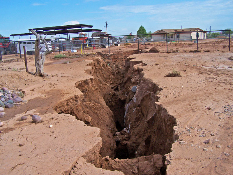
Fissures tear the earth in Arizona and we are not sure what these Arizona giant cracks are!
It’s not something you see every day on the Navajo Nation, but cracks in the earth have been forming for a long time now and no one seems to have a clear answer.
Giant cracks not only open up in Mexico, but also in arid Arizona. And their formation may be closely related! These earth fissures pose danger to cattle, wildlife, and unwary humans. And, because they tend to develop perpendicular to surface drainage, they can capture runoff and develop into large gullies.
Most earth fissures in Arizona occur in the corridor between Tucson and Phoenix, and from Phoenix west along interstate 10. Here an example of one of these Arizona giant cracks that opened up on the Navajo Nation ground. The still growing 900 feet long crack is 12 miles north of I-40. It is up to 500 feet deep in places. The USGS has no real answer other than growing tensions in the local rock formations have caused the cracks to form.
This giant fissure sits east of Flagstaff on Luepp Rd and about one mile west of Leupp gas station. It’s gotten so big, that they had to fence it in. The giant fissure has many residents on the Navajo reservation and in the state of Arizona concerned as fears grow over the expansion of the crack.
With the last year collapse of highway 89 near Page, some local residents wonder what mother nature has in mind for the vast reservation:
So how do these cracks form?
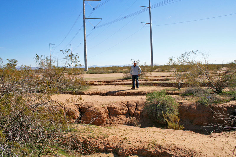
As explained on the Arizona’s Earth fissure center:Earth fissures are associated with basin subsidence that accompanies extensive ground water mining. In Arizona, fissures were first noted near Eloy in 1929. Their physical appearance varies greatly, but they may be more than a mile in length, up to 15 ft wide, and 100s of feet deep. During torrential rains they erode rapidly presenting a substantial hazard to people and infrastructure. Moreover, fissures provide a ready conduit to deliver runoff and contaminated waters to basin aquifers. Rapid population growth in southern Arizona is increasingly juxtaposing population centers and fissures.

Giant desiccation cracks are common in southwestern U.S. playas and have been reported in several areas of Arizona but they are much more common than previously recognized. These giant cracks are similar to mudcracks or large soil cracks, but on an enormous scale. The cracks themselves are up to 3 feet (1 m) wide, up to 9 feet (2 m) deep (apparent depth), and a few are on the order of 1000 feet (300 m) long. They form polygonal blocks that look identical to the shape of mudcracks, but the polygons are characteristically 150-600 feet (45-180 m) across whereas typical mudcracks form polygons 4-8 inches (10-20 cm) across and large soil cracks form polygons 2-6 feet (0.5- 2 m) across. Some giant desiccation cracks are large enough to be mistaken for earth fissures that are caused by subsidence from groundwater pumping.

